
Crooked Creek Horse Park – Ford City, Pennsylvania
Photos on bottom of page
Check Out Our Event Calendar For Events Here
Crooked Creek Horse Park
467 Crooked Creek Dam Road
Ford City, Pennsylvania 16226
Phone : 724-571-5071
Email : ccparkrental@gmail.com
Ford City, Pennsylvania Weather
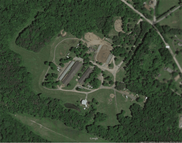
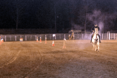
Located in beautiful western Pennsylvania, Crooked Creek Horse Park has much to offer to the horse enthusiast. The park is 97.5 acres and lies within the Crooked Creek Park and Lake system. It is operated by the Fort Armstrong Horsemen’s Association, Inc. The horse park is a multi-use facility and offers just about everything for the horse lover, including horse shows, fun shows,
trail and endurance riding, clinics, a full scale rodeo and much more. There is full hook-up and primitive camping space. Fees are based on types of usage. The park has restrooms with showers. We also have a full service kitchen on the park grounds. The kitchen is usually open during park events. There are several restaurants and hotels within a few miles of the park.
There are three barns with a total of 198 stalls. There are approximately 35-40 miles of permanently marked trails with two long loops of approximately 18 and 35miles and several smaller loops. The trail system is maintained by volunteers. The trails are challenging with lots of short hills and no long climbs. Water is plentiful, terrain is varied with many stream crossings, pipelines, woodsy trails, some rocky areas and mud. Maps of the trails are available at the Park Information Center.
Crooked Creek Horse Park is separate from the main park, Crooked Creek Park and Lake, which is operated by the Army Corp of Engineers and is located about a mile (within walking distance) from the horse park. There is a large beach with swimming, boating, fishing and other recreational activities.
Directions to Crooked Creek Horse Park
FROM PA TURNPIKE – EXIT 5 – At Allegheny Valley exit take Rte. 28 North for 30 miles towards Kittanning. Watch for Ford City, Rte. 28N, 422E and Rte. 66 signs. After crossing the Allegheny River, exit to the right off bridge on Rte. 66 South to Ford City. Watch signs carefully as 28 and 422 go straight ahead. FOLLOW MAP – at this point you are about 4.6 miles from the horse park.
FROM PA TURNPIKE – EXIT 8 – At New Stanton take Toll Road Rte. 66 North for 14 miles. Toll Road ends at Delmont. Continue on Rte. 66 North for 12 miles through Apollo and North Apollo. At stop light in N. Vandergrift turn right on ALT Rte. 66. Follow Alt. Rte. 66 about 10 miles back to Rte. 66. FOLLOW MAP – at this point you are about 2 miles from the horse park.
FROM I-80 EXIT 10 TRAVELING EAST – Rte. 66 South for 12 miles to New Bethlehem. Rte. 66 and Rte. 28 South for 20 miles towards Kittanning. Exit towards Ford City before crossing river. FOLLOW MAP – at this point you are about 5 miles from the horse park.
FROM I-80 EXIT 13 TRAVELING WEST – Rte. 28 South for 40 miles towards Kittanning. Exit towards Ford City before crossing river. FOLLOW MAP – at this point you are about 5 miles from the horse park. FROM I-79 EXIT 29 – Rte. 422 East for 34 miles towards Kittanning. After crossing the Allegheny River, exit to the right off the bridge on Rte. 66 South to Ford City. Watch signs carefully as Rte. 28 and Rte. 422 go straight ahead. FOLLOW MAP – at this point you are about 4.6 miles from the horse park.